Physical Setting

Area Occupied: 176.7 acres (71.5 hectares)
Stand Size:

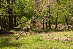
Long, narrow stretches, only as wide as the floodplain

Landscape Position:

Floodplains of streams, including floodways and floodplain terraces

Soils:

Varies from poorly drained, fertile, silty loams to well-drained, coarse sediments such as sand and cobbles

Geology:

Varies—new minerals and organic matter regularly introduced during floods

Other Websites

Rock Creek Park

Rock Creek regularly floods the land adjacent to it.
Photographer: Ryan Valdez
Most stream banks along Rock Creek host long winding ribbons of the Tuliptree Small-Stream Floodplain Forest. (Exceptions include where steep, bouldery hillsides go straight down to the creek, hosting a different natural community; where stretches along the creek are mowed for picnic areas; or where viney and non-native vegetation have taken the upper hand.)

Land on which the Tuliptree Small-Stream Floodplain Forest is found can be temporarily flooded when waterways overflow their banks. It includes both the floodway (the area immediately bordering the stream that receives the most frequent and turbulent floodwaters and debris during flooding) and the floodplain terrace (relatively flat areas just beyond the floodway). Floodplain terraces may be quite a bit higher than the stream or only slightly above the stream. The width of this natural community varies with the floodplain width, from as much as 500 feet (150 meters) along Rock Creek in the far north of the park, to very narrow after the creek enters a gorge shortly beyond Fenwick Branch.

On floodplain terraces, soils are silt loams, that is, made of silt, sand, and clay with silt predominating. The soils are fertile because they are regularly enriched with fine-textured, often nutrient-rich sediment from upstream that settles out of slowly receding floodwaters. They are deep because flood sediments are added regularly, and they drain slowly because they are fine textured and the landscape is flat. Floodplain soils are not strongly influenced by the underlying bedrock because of the constant introduction of new minerals and organic matter during floods. Moisture conditions fluctuate between floods and droughts.

In the floodway, by contrast, floodwaters that move more swiftly than on the floodplains dump much coarser, heavier sediments, through which receding floodwaters or rain rapidly drains. Ever-shifting bars made of sand, gravel, and cobbles are a common feature of this landscape. They form islands in the active stream channel, and crescent-shaped raised areas on the inside of stream bends along the banks. Deposits may form small natural levees along the stream’s banks, which can alter the water’s path. As with floodplain soils, these sediments are not much influenced by underlying bedrock because of the constant introduction of new materials from upstream.

Notable Variations

Regionally, ribbons of Tuliptree Small-Stream Floodplain Forest stretch long and narrow on streamside terraces. But as Rock Creek winds south through Maryland and nears the D.C. boundary, hills block the stream's southward progress. As the stream turns east before finding its way south again through a narrow valley, its floodplain broadens significantly.

Prairie-like opening on a broader section of the Rock Creek floodplain.
Photographer: Sam Sheline, courtesy of NatureServe
On the Rock Creek Park map, the vegetation on this broad section of floodplain just east of Boundary Bridge and the Maryland/D.C. boundary is mapped as Tuliptree Small-Stream Floodplain Forest. However, this is not your typical Tuliptree Small-Stream Floodplain Forest. The floodplain here is broader than would be typical for this natural community—so broad that there is actually a patchwork of different microhabitats interwoven together on this floodplain. Some patches look more like grasslands or shrublands than forest: open, flood-scoured sand or gravel bars dotted with grasses and sedges and surrounded by braided stream channel; or tall, shrubby smooth alder huddled together near water’s edge, for instance. Why didn't these patches get mapped as separate kinds of natural communities, as they might have on a broad river floodplain?

At Rock Creek Park, this mosaic of different microhabitats on the floodplain is mapped as a single though variable natural community since the microhabitats are under an acre in size—too small to map. That natural community, the Tuliptree Small-Stream Floodplain Forest, has been defined/classified here at Rock Creek Park to encompass more variability (microhabitats) than is typical for the Tuliptree Small-Stream Floodplain Forest elsewhere.